Current Temp. 52°
Discover
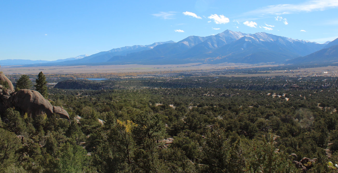
The Midland Trail might be one of the best kept secrets in Buena Vista. The rocky ridge with pinions directly east of Buena Vista is named Midland Hill, and the Midland Trail leads to its summit.Although by no means easy, it is a more moderate climb compared to nearby fourteener trails and other difficult higher elevation trails west of the Arkansas River Valley. At the summit (9,556’), one has stunning views of the valley and the Collegiate Peaks. If you love the Buena Vista and its mountain views, you may think this is a “little piece of heaven”. For photographers, hiking early is usually best, as the morning sun is east and at one’s back as one faces the mountains.
Directions: From Johnson Village, travel east on Highway 24 and turn left at the Collegiate Peaks Overlook. Make an immediate right and take this dirt road (Chaffee County Road 304) to a fork and stay left on 304. The road narrows – it is the historic railroad grade of the Midland Railroad. Continue for approximately 1.5 miles and the trailhead is marked as “6032” on the right.
The trailhead can also be accessed via the Barbara Whipple Trailhead. Travel on East Main Street to the end, park in the large lot, and start at the bridge over the Arkansas River. The Whipple Trail ascends to Chaffee County Road 304 and the “6032” trailhead.
Area Map available at GARNA MAP


Get Deals, Discounts, Information and more, in your inbox!
 Printable Version